Proper compliance with Federal, State, and Municipal regulations (throughout the Midwest).
 Archaeological Background – Historical Context (Context Statement and Cultural Histories) – Research to determine if there are previously recorded sites or surveys, and the existing knowledge of a project area.
Archaeological Survey – Field survey to identify cultural resources.
Archaeological Testing – National Register of Historic Places evaluations for determinations of eligibility.
Archaeological Data Recovery – Full scale mitigation & data recovery excavations of archaeological sites.
Monitoring of activities in and around culturally sensitive historic and prehistoric areas.
Geomorphology – use of soil coring and deep test trenching to identify sites in buried deposits.
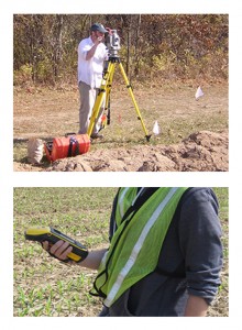
 Total Station – Topographic and site mapping using laser total station.
GIS – we use ArGIS software to produce site maps and export to a number of graphic and geographic formats.
GPS – Trimble hand held sub-meter GPS receivers.

